Water Supply on Off-Grid Land in the UK: What to Check
Securing a lawful, reliable water source is one of the most critical—and least predictable—checks when buying off-grid land. This guide explains what you need to verify, from boreholes and licensing to flood risk.
The honest answer
You cannot assume a plot of land has water, nor that you can legally abstract it even if it's there. Whether you're exploring off grid water supply UK options on agricultural land or a remote woodland, water is a make-or-break due-diligence check—and one where hope and guesswork can cost you tens of thousands of pounds. A borehole off grid UK installation might succeed at 30 metres or fail at 100; a spring might run all winter and vanish by July; and even if you find water, abstracting more than 20 cubic metres a day (roughly 4,400 gallons) requires an Environment Agency licence in England or a Natural Resources Wales permit in Wales. Add flood risk—which affects both safety and whether you can put any structure on the land—and you have a cluster of unknowns that demand professional checks before you exchange contracts.
This guide stays on the due-diligence axis: what sources exist, what consents and licences apply, what checks to run, and how to verify a specific plot. It is not a how-to-drill manual.
Frequently asked questions
Checking whether a plot has a viable water source?
Enter the plot's postcode and we'll check planning status, green belt, Article 4, flood risk and lawful access — in plain English.
£34, results in minutes, no account needed. Or see a sample report first.
Do I need a licence for a borehole on off-grid land in the UK?
Can you drill a borehole anywhere in the UK?
What is the Environment Agency abstraction threshold?
Can I buy off-grid land in a flood zone?
How do I check if off-grid land has a reliable water supply?
What happens if my off-grid borehole runs dry?
Why water supply is a critical plot check
Mains water does not reach most off-grid plots. If the land is classified as agricultural, woodland, or otherwise outside a settlement boundary, you will almost certainly need to source water independently—whether for a dwelling that needs planning permission, an agricultural building, or any other lawful use.
The twin risks are availability and legality. Groundwater, springs and surface watercourses are not guaranteed to exist, to be accessible year-round, or to yield enough volume for your intended use. Even where water is present, the law controls how much you can take and what you must do to the land to access it (which may itself need planning permission or other consents).
Unlike off-grid power—where solar, wind or a generator can usually be installed if planning and permitted development rules allow—water is geological, hydrological and jurisdictional. You cannot simply "add" it if it isn't there, and you cannot take it freely if it is.
Off grid water supply UK: the main options
Boreholes
A borehole is a narrow, deep hole drilled into an aquifer (a layer of water-bearing rock or sediment). If successful, it can provide a long-term, high-volume supply. If unsuccessful, you have spent £5,000–£15,000+ on a dry or low-yield hole.
What you need to check:
- Geological likelihood. The British Geological Survey's online GeoIndex map shows aquifer designations (principal, secondary, unproductive). A principal aquifer does not guarantee success, but an "unproductive strata" designation makes it far less likely. Neighbouring boreholes—visible on some BGS datasets or known to local drillers—offer clues, but hydrology varies across a single field.
- Depth and cost. Drilling costs are typically charged per metre. A 30-metre borehole in chalk might cost £3,000–£5,000; a 100-metre attempt in clay or granite could exceed £12,000 and still fail. Most reputable drillers will not guarantee yield or even water presence.
- Consents. Drilling itself does not always need planning permission (it may fall within permitted development for agriculture, though councils differ), but if you are drilling to serve a dwelling or installing a pump house or header tank, check with the local planning authority. You must also notify the Environment Agency in England (or Natural Resources Wales in Wales) at least 28 days before drilling, even if no abstraction licence is required.
- Abstraction licensing. If you abstract 20 cubic metres or more per day (averaged over any continuous period), you need an Environment Agency licence in England or a Natural Resources Wales permit in Wales. Most domestic/smallholding use falls well below this threshold—20,000 litres is roughly 4,400 gallons—but commercial agriculture, market gardening or any scheme involving livestock watering at scale can cross it. Crucially, the threshold is per property or holding, not per borehole. Abstracting without a licence where one is required is a criminal offence.
The reality: A borehole off grid UK can be transformative or a expensive dead end. Always budget for failure and, where possible, commission a desktop hydrological report or trial borehole survey before exchange.
Springs and wells
A natural spring or an existing well can be a low-cost, sustainable source—if it runs year-round and the water is potable (or treatable to potable standard).
What you need to check:
- Seasonal reliability. Many springs are winterbournes: they flow in wet months and dry up in summer. Visiting a plot once in February tells you nothing about July. Ask the seller for evidence of year-round flow (photos, previous use, neighbour testimony) and, if the land has been in their ownership long enough, request documentation.
- Water quality. Spring and well water is not automatically safe to drink. You will need laboratory testing (microbiology and chemical) and, depending on results, filtration, UV sterilisation or other treatment. The Drinking Water Inspectorate sets standards for private supplies; your local authority environmental health team has enforcement powers if the supply serves a dwelling.
- Abstraction. The same 20 cubic metres/day threshold applies. A trickle spring feeding a header tank for a single off-grid home will not trigger licensing, but diverting a larger spring or stream for irrigation may.
- Legal rights. Groundwater beneath your land is yours to abstract (subject to licensing thresholds and environmental law). Surface water in a stream or river is not: riparian rights allow reasonable domestic use, but larger abstraction requires a licence. If a spring rises on neighbouring land and merely flows across yours, your rights are limited.
The reality: An existing, proven spring is gold dust. An untested one is a gamble that demands professional verification and seasonal monitoring before purchase.
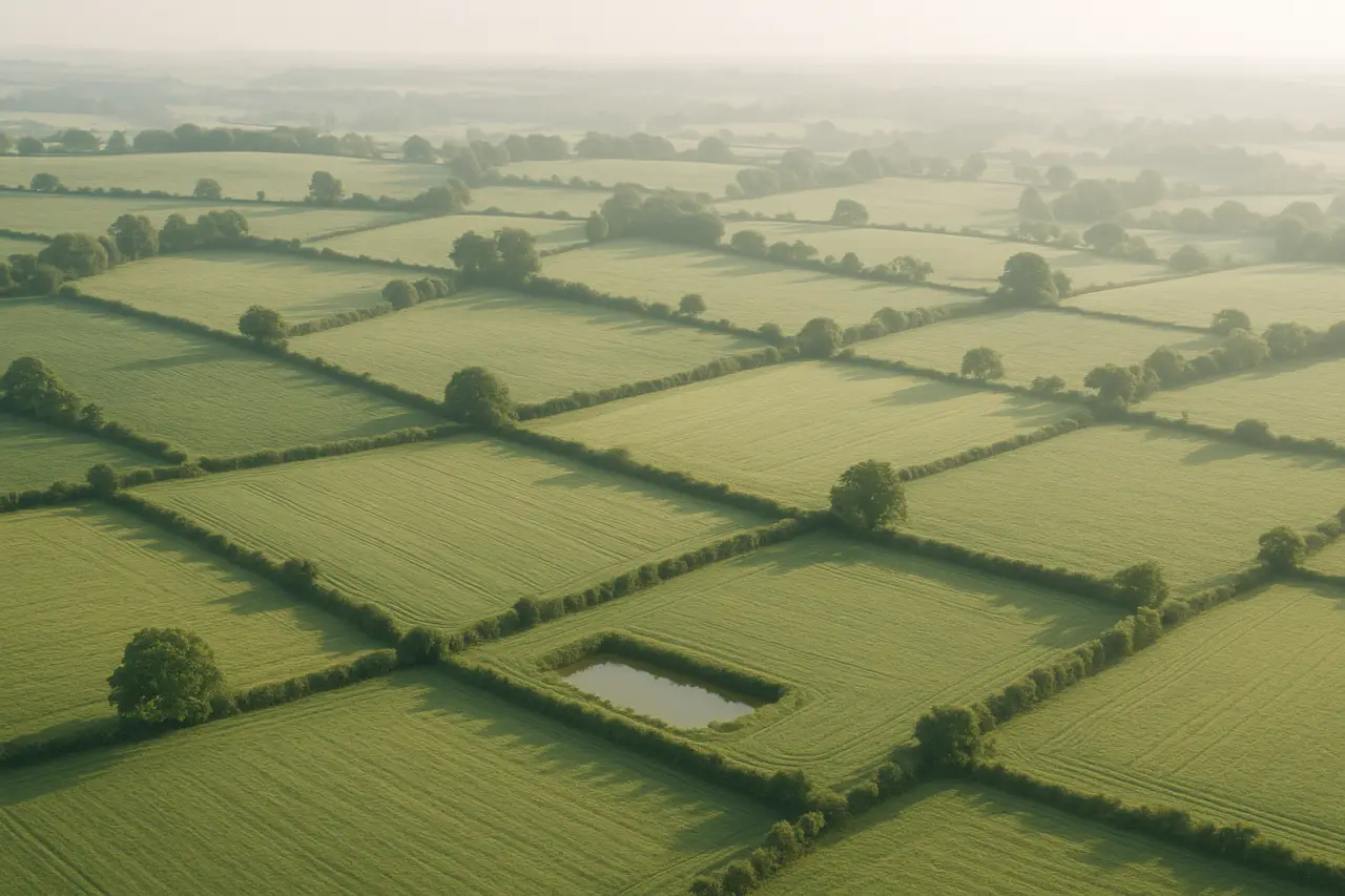
Watercourses (streams, rivers, ponds)
A stream or river running through or alongside your plot offers potential for abstraction or, in some cases, micro-hydro generation (which is outside this guide's scope but may need abstraction consent and planning permission).
What you need to check:
- Riparian rights vs. abstraction licence. You have a common-law right to abstract a reasonable quantity for ordinary domestic use (drinking, washing, watering a garden) without a licence. Anything beyond that—irrigation, livestock, commercial use, or volumes approaching 20 cubic metres/day—requires an Environment Agency or Natural Resources Wales licence. The threshold is lower in protected catchments and during drought orders.
- Flow reliability. Many small streams are seasonal or diminish in dry summers. The Environment Agency monitors "hands off flow" conditions in some catchments; during low-flow periods, even licensed abstractors can be restricted.
- Flood risk. See the dedicated section below.
- Water quality. Surface water is more vulnerable to contamination (agricultural run-off, livestock, wildlife) than deep groundwater. Treatment will almost always be necessary.
Ponds are a separate category: if you dig or maintain a pond on your land, that water is yours, but a new pond may need planning permission (it is an engineering operation and can affect drainage), and abstracting from an off-site pond or lake requires consent from the landowner and possibly a licence.
Environment Agency abstraction licensing: the 20 cubic metres threshold
This is the single most misunderstood aspect of water supply off grid land projects in England.
The rule (England): You need an abstraction licence if you take 20 cubic metres or more per day from any source of supply (borehole, spring, stream). The measurement is averaged; occasional peaks do not trigger the threshold, but sustained daily use does. Domestic use for a single household almost never reaches 20,000 litres/day. A small off-grid smallholding with a vegetable garden, a few chickens and modest irrigation will typically use 1,000–3,000 litres/day.
When you do need a licence:
- Market gardening or polytunnel irrigation at scale.
- Livestock watering for a commercial herd.
- Multiple dwellings sharing one abstraction point (the threshold is per source, not per tap).
- Any use in a protected catchment or Special Area of Conservation (the Environment Agency can impose lower thresholds).
In Wales, the same framework applies, administered by Natural Resources Wales.
Enforcement: Unlicensed abstraction is a criminal offence under the Water Resources Act 1991. The Environment Agency has wide investigatory powers, and penalties include unlimited fines. If your off-grid plan depends on high-volume abstraction, budget for licence application (currently around £1,500 in England) and expect conditions (metering, reporting, hands-off flows).
How to check: The Environment Agency's public register shows existing licensed abstractions nearby. This does not tell you whether you will be granted a licence (that depends on catchment status and environmental impact), but it signals whether the aquifer or watercourse is already under pressure.
Flood risk and how it affects off-grid land
Flood risk is both a safety check (can you live/work here without regular inundation?) and a planning/permitting constraint (will the council or Environment Agency allow structures here?).
Flood zones (England):
- Flood Zone 1 (low risk): less than 0.1% annual probability of river or sea flooding. Most development is steered here.
- Flood Zone 2 (medium risk): 0.1%–1% river flood probability. Development may be allowed with flood-risk assessment and mitigation.
- Flood Zone 3 (high risk): greater than 1% annual probability. New residential development is generally refused unless there are exceptional circumstances and the Sequential and Exception Tests are passed. Caravan sites, camping, and "highly vulnerable" uses are prohibited in Flood Zone 3a; in 3b (functional floodplain), almost all development is refused.
Wales uses the same framework, managed by Natural Resources Wales.
Why this matters for off-grid plots:
- Many off-grid land for sale parcels are cheap because they are in Flood Zone 2 or 3. You will struggle to gain planning permission for a dwelling in Zone 3, and even permitted development (agricultural buildings, some mobile structures) is restricted.
- Even if you do not need planning permission for your intended use (e.g., grazing), regular flooding makes the land unusable for off-grid living infrastructure: septic tanks can be inundated and contaminate floodwater, boreholes and springs can be polluted, and access can be cut off for weeks.
- Insurers will not cover dwellings or contents in high flood-risk areas, or premiums will be prohibitive.
How to check:
- England: Gov.uk flood map for planning
- Wales: Natural Resources Wales flood maps
- For surface water (pluvial) flood risk, use the Environment Agency's "Long term flood risk" map, which also shows historic flood events.
If a plot sits in Flood Zone 2 or 3, commission a professional Flood Risk Assessment before exchange and speak to the Environment Agency about the likelihood of future consent for any structure.
What consents and permissions apply
| Activity | Consent/permission typically needed |
|---|---|
| Drilling a borehole | Notify Environment Agency (England) or Natural Resources Wales 28 days ahead; planning permission may be needed depending on use and structure (check LPA). |
| Abstracting <20m³/day (domestic) | None (but you must still comply with environmental protection law). |
| Abstracting ≥20m³/day | Environment Agency abstraction licence (England) or NRW permit (Wales). |
| Building a pump house, storage tank, or treatment building | Usually planning permission or confirmation it falls within permitted development (agricultural buildings have separate rules; domestic curtilage structures have size/height limits). |
| Digging a new pond | May need planning permission (engineering operation; affects drainage); may need Environmental Permit if >5m deep or in a sensitive area. |
| Discharging water (e.g., septic soakaway, treated effluent) | May need Environment Agency environmental permit (separate from abstraction). Package treatment plants discharging to ground usually need a permit or exemption; septic tanks to soakaway below 2m³/day often qualify for an exemption, but rules tightened in 2020. |
The key point: "Off-grid" does not mean "unregulated." Water law is strict, and environmental enforcement can result in stop notices, remediation orders and prosecution.
How to check a specific plot
Before making an offer on off-grid land, run these checks:
Planning status and history
Check the local planning authority's public register for any history of planning applications (especially refusals for dwellings or water-related infrastructure) and confirm current use and any conditions.Flood risk and water
Use the Gov.uk flood map for planning (England) or NRW maps (Wales) to confirm flood zone. Check the Environment Agency's long-term flood risk map for surface water and historic events. Search the EA public register for existing licensed abstractions nearby.Hydrogeology and borehole likelihood
Review the British Geological Survey's GeoIndex for aquifer classification. If the seller claims a borehole, spring or well exists, request evidence: drilling logs, yield test results, water quality test certificates, and photos of the installation.Access and rights of way
If water infrastructure (borehole, spring capture, storage tank) is located away from the plot boundary, confirm you have legal access and that no ransom strip or third-party consent blocks installation or maintenance.Environmental and landscape designations
National Parks, Areas of Outstanding Natural Beauty, Sites of Special Scientific Interest, Special Areas of Conservation and National Nature Reserves all impose additional controls on water abstraction, groundworks and structures. Check Magic Map (England) or Lle (Wales).Lawful use and any Article 4 directions
Confirm what you can lawfully do on the land (residential, agricultural, forestry, amenity) and whether an Article 4 direction restricts permitted development.
The fastest, most reliable way to run these checks on a specific plot in England is a BuyLand Plot Report. You'll get planning history, flood risk, designations, access, and contamination data in one plain-English document. See a sample report here or order a full report before you make an offer.
(Note: Plot Reports currently cover England only. For plots in Wales, you will need to check the local planning authority, Natural Resources Wales, and Lle Geo-Portal manually.)
Jurisdiction: England vs. Wales
England:
- Environment Agency regulates abstraction, licensing (20m³/day threshold), borehole notification, and flood risk.
- National Planning Policy Framework (NPPF) governs development in flood zones (Sequential Test, Exception Test).
- Drinking Water Inspectorate and local authority environmental health oversee private water supply quality.
Wales:
- Natural Resources Wales regulates abstraction, permitting, borehole notification, and flood risk.
- Planning Policy Wales and Technical Advice Notes (including TAN 15 on flooding) set the framework.
- Private water supply regulation is the same (EU-derived standards retained post-Brexit).
- One Planet Development—a distinct consent route for off-grid smallholdings in Wales—has specific water-sustainability requirements but does not exempt you from abstraction licensing or environmental permitting if thresholds are crossed.
Always confirm which nation's rules apply, and cite the correct regulator when seeking pre-application advice.
The bottom line
A reliable, lawful off grid water supply UK source is not a given—it is a gamble you can narrow with due diligence but never eliminate until after you drill, test, or monitor. Boreholes can fail. Springs can dry up. Abstraction can require expensive licensing and metering. Flood zones can render land unbuildable and uninsurable.
Do not buy off-grid land assuming you will "sort out water later." Commission a desktop hydrological assessment, check flood risk and abstraction licensing, and—where possible—make the contract conditional on a successful trial borehole or spring-flow test. If a seller claims "there's a spring" or "the neighbour has a borehole," ask for evidence and verify it independently.
Water is the one input you cannot fake, import cheaply, or do without. Treat it as the primary constraint, not an afterthought, and you will avoid the single most expensive mistake off-grid land buyers make.
For the full planning and due-diligence picture, read our pillar guide: Can You Live Off-Grid in the UK? The Planning Reality. And before you make an offer, run a Plot Report to uncover the flood risk, planning history, and designations that govern what you can—and cannot—lawfully do with the land.
Get a Free Land Valuation
Use our calculator to get an instant estimate of land value in your area.
Free Valuation